Navigator screen shots
In this section, you will see how Navigator features look like:
Star FinderThe figure below shows the Navigator's star finder window. This is a polar chart of the visible sky in a given time and position. You can point a star and see it's data (Name, Altitude and Azimuth). Or you can point on the spreadsheet and see the corresponding objects on the chart.
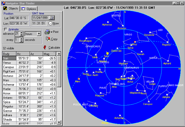
The center of the chart is the Zenith and the external circle is the
horizon. The two blue concentric circles are the 30° and 60° altitude.
The best stars to observe are between these two circles (altitudes between
30° and 60°) .
Line of Position
Calculating a Line of Position is easy. Input:
- Date and GMT time of the observation. You can also input the local time and click GMT!. The program will calculate the GMT time, adding the time zone and watch error. Click Now! to fill with the current date and time.
- Select the star observed.
- Instrumental altitude of the star. For the Sun and Moon, use the altitude
of the lower limb, as shown.
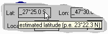
- Estimated position (Latitude and Longitude).
- Index Error in minutes and Height of the eye in meters or feet.
Press Calculate. The LOP will show in the chart, as illustrated.
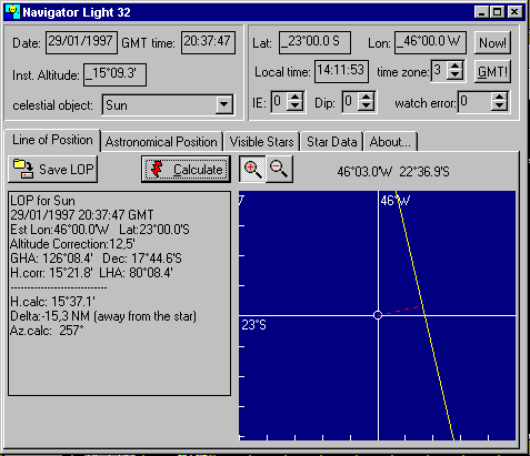
All input fields and buttons have hints that explain what they are and what units should be used. Place the cursor over the field to see the hint.
Astronomical position
After you calculate two or more Lines of Position, you can calculate your astronomical position. The figure bellow shows an astronomical position calculated with 2 LOPs. Note the blue chart, showing the LOPs diagram. The astronomical position is indicated by the white circle. Use the cursor to zoom in and out. Auto transport LOP feature makes calculating a running fix an easy task.
![]()
Chart Navigation
Navigator Chart Viewer can work with vector and raster charts. Vector charts can be produced with ChartMaker program (also included in the registered version). There are a couple charts available in our chart library. It can also import popular raster image formats, like GIF, JPG and BMP. None of the other proprietary chart formats is supported at this time.
In the Navigator chart viewer you can:
- View multiple charts, integrated in a whole world vector chart background.
- Draw routes and calculte leg distances and courses
- Connect a GPS and save your track on-line
- Draw marks, with text.
- Calculate rhumb lines and lines of great circle and generate routes.
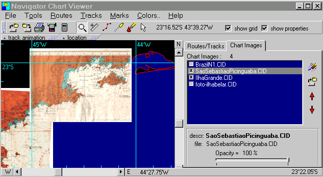
Chart viewer showing a raster chart zoom animation
©Copr 92-2012 Omar F. Reis - All rights reserved