Page 1 of 1

Extractor

PostPosted: Wed Mar 04, 2015 9:35 pm
by Thierry dArgenlieu
Hi Omar,
Is there a coastline extractor software for .cht files ?
(extracting portion of world map from gshhs_f.cht )
Thank you - Thierry

Re: Extractor

PostPosted: Fri Mar 06, 2015 12:03 pm
by omar
You mean to extract only the polygons on a certain area ?

Re: Extractor

PostPosted: Sun Mar 08, 2015 6:49 am
by Thierry dArgenlieu
Omar hello,
as you already know it is imperative to have the edge pixels of land to use VRTool properly.
I suggest you to develop a global map accessible to all (to replace the dead vrtoutoulz site) and to file it on your page Wiki.
This tool (coastline extractor) might be a critical complement to VRTool.
And a better service to the virtual sailors community....
Thank you - Thierry

Re: Extractor

PostPosted: Mon Mar 09, 2015 8:09 am
by Thierry dArgenlieu
Another question please.
I am trying to use ChartMaker to produce CHT files.
Is it possible to use the portions of VR map, appearing within the cache of the navigator (chrome), to produce .cht files ?
Those files come without geographic reference points...

Re: Extractor

PostPosted: Mon Mar 09, 2015 10:16 pm
by omar
Thierry dArgenlieu wrote:use ChartMaker to produce CHT files


ChartMaker was designed to import images of charts that
are Mercator projections (like most nautical charts).

If you import a screen shot of VR app, the chart image will not
fit over the vector chart because game app chart is not
a Mercator projection (i.e. degrees have fixed width=height).
In a true Mercator projection, degree heights should increase
as you move away from the Equator.

To see that, look at the image below. This is a game screen shot
projected on the vector chart (GSHHS full). While the chart fits on
reference points I used (1,2 and 3) it fails in between (red arrow)

Image

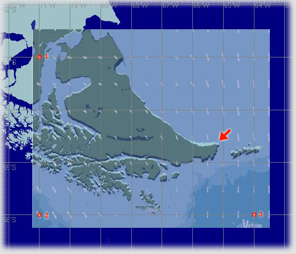
The difference is in latitude, and is greater for high latitudes.
It is due to Earth surface curvature. VRTool chart
is not a Mercator projection either. It uses fixed height for degrees.
But degree heights are larger than widths,
allowing a better representation of courses.
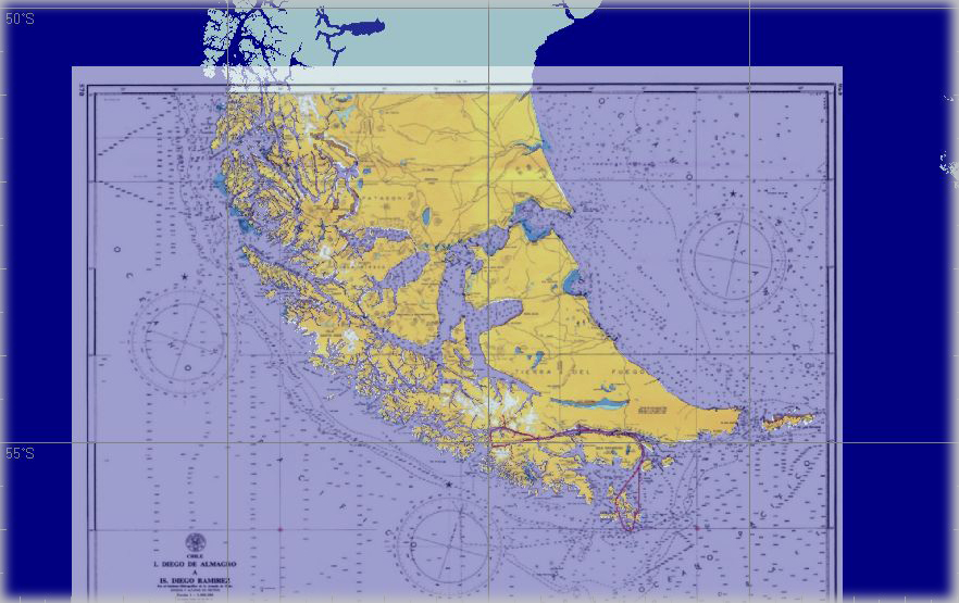
If you zoom in on a VRTool chart, it is close to a Mercator projection.

The image below shows a projected nautical chart.

Image

Note: ChartMaker is part of Navigator software (also includes CelNav).