routes that go over land (collision detection). However the leg buoys are not
represented in that file (monoBmpGSHHS_24k12k.bmp distributed with the program).
This may result in illegal routes, passing trough the wrong side of the buoy.
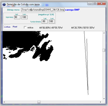
To avoid this, open vrtool collision detection module and select the Line tool.
Use the coordinates to locate the buoy position and click it once.
Click another point to create the no-pass line (p.e. to the North of the buoy)
Note that the lines are temporary (not saved to the bitmap itself).
If vrtool is restarted, the lines are lost and must be recreated.